
G2 Weather Signal™ — Friday Flash Update
Weather Signal Holds — Warmth Strengthens Into Next Week

Signal Summary
This week ended largely as expected. The split pattern held, with persistent warmth across the South and West and colder-than-normal conditions across the Midwest and Northeast. There were no material surprises in either temperature or precipitation that would alter the near-term read.
Looking ahead to next week (week ending Jan 10), the forecast warmth has strengthened. Warm anomalies are now more widespread and more durable than early-week guidance suggested, while the risk of sustained cold in the Midwest and Northeast has diminished.
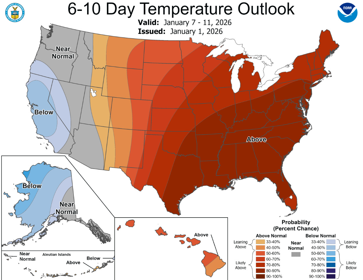
Context matters in January. Outside of disruptive extremes, weather typically has less influence on retail outcomes in mid-winter than it does during spring and fall transition periods. That means this signal is more about mix and timing than demand creation — and why confirmation, not surprise, is the right lens for this update.
